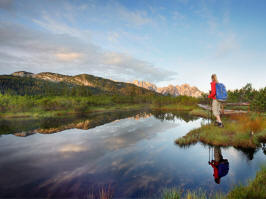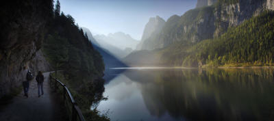
Walking tours for all abilities

Obertraun and the Krippenstein is the perfect base for walkers and nature lovers of all levels of fitness and experience. Enjoy many low-level walks in the valley, or if you prefer something more strenuous, there are trails between 500 and 2100 meters above sea level to choose from. A ride on the Krippenstein Cable Car brings you to 1600m in just a matter of minutes.
The Dachstein Hiking World stretches from the Koppentraun River valley to the Dachstein massif with its peak ranges. It features plenty of enjoyable hiking routes as well as demanding mountain and climbing tours. A network of well groomed nature trails and footpaths covers the area from the valley station at Obertraun to the ice-fields at an altitude of almost 3.000m. Our nature trails are designed to introduce their users to exciting information about the surrounding plateau - in relaxing hiking atmosphere.
The "Dachstein Hiking World" around Obertraun is a wonderful place to be.
Whether you go hiking alone or with others, are experienced or not, have a young baby, there is something suitable for you in Obertraun.
The Salzkammergut has far too many great walks to list here, so we have concentrated on the best walks that can be started here in Obertraun.
Continue reading for information on Low level, Easy, Medium, Strenuous, Climbing or Themed tours....
Low level walks
Schergenkogel:
This easy walk begins at the Winkler Stube inn. Follow the forest track
as it gradually ascends to the scenic view point on the Schergenkogl.
There is a flag here and also a walkers’ bench where you can take a rest
and enjoy the views (alternatively you could extend your walk to the
Schafeck, the Krippenbrunn or the Gjaidalm!) Difference in altitude
approx. 200 metres. Recommended route (round trip) approx. 3
kilometres. Allow about one and a half hours.
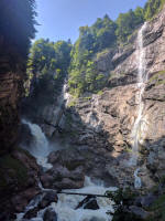
Waterfalls:
Begin your walk at the “Stiegergasse”. This is a little alleyway, just
off the shore road, between the catholic church and Maislinger’s
bakery. Continue along the tarmac path for about 200 m, and our ascent
begins as we cross the “Hohenweg” (higher road). About 40 minutes from
this point we should reach our destination which is indicated by a
red/white/red flag. There are benches where you can take a rest and
enjoy stunning views of the Obertraun basin, Lake Hallstatt and the
surrounding mountains. Difference in altitude approx. 250 m.
Recommended route (round trip) approx. 3 km. Allow about one and a half
hours.
Hirschau-Alm:
Our walk begins at the “Kessel” lake bathing area between Hallstatt and
Obertraun. Pass the “Kessel” ( a karst spring which becomes active
during prolonged periods of heavy rainfall and when the snow melts. The
spring is a wonder of nature and is under a preservation order.) Follow
the path (Almweg) for about an hour until you reach the Hirschau-Alm
pasture. Cattle graze here only in early summer, but the original
wooden hut still exists. The beautiful alpine roses add to the idyllic
scene. You can either re-trace your steps back to the car park, or
alternatively, walk down to Hallstatt. The path twists and turns for a
short while before we join the romantic trail via the so-named “Schoss”
(carved out by an avalanche) and continue your walk through the mixed
forest. This brings us out at the petrol station in Hallstatt. Follow
the footpath now alongside the main road as you return to the car park
and bathing area. Difference in altitude approx. 200 m. Recommended
route (round trip) approx. 6km. Allow about 3 hours.
Hallstättersee-Ostuferwanderweg:
The Lake Hallstatt eastern shore trail begins 5 minutes’ walk from the
railway station, near the Obertraun boat landing and the “Seerose”
apartment hotel car park. Take the railway underpass, pass the
“Seeruhe” (rest benches here with lovely views towards the “Haus am See”
hotel and the lake bathing area.) After about 40 minutes, we reach the
lake shore and can enjoy stunning views of Hallstatt; the town famous
for its 4500 year history of salt mining. Continue past the Hallstatt
train stop and cross the picturesque, firmly secured hanging bridge.
Our route continues along the lake shore. After a further hour and a
half we reach the “Wanderwegstueberl” and the Obersee train stop. From
here you can take the boat to Steeg or Hallstatt. Take a break here, if
needed, and then head towards Steeg. A further hour is needed to reach
the village of Au and the main road/Steeg-Gosau railway station. From
here you can catch the train back to Obertraun! You can, of course, do
this walk in reverse and walk from Steeg to Obertraun. This is a
perfectly level trail. Recommended route approx. 6 km. Allow about 3
and a half hours.
Dachsteinhöhlenpfad (Dachstein caves trail):
Our trail begins at the Koppenbrüller Cave train stop. We pass the
Koppenwinkl lake and then follow a forest path to the
Dachstein-Krippenstein cable car which brings visitors up to the Giant
Ice and Mammoth Caves. Our route continues down through the woods to
the “Dachsteinhof”. Cross the Koehler Bridge and follow the Höll-Karl
trail through the village to the Obertraun/Dachsteinhöhlen railway
station. All along the Dachstein caves trail there are many beautiful
scenic view points where you can stop and enjoy a rest. This stroll
through the idyllic Obertraun World Heritage Region is a perfect means
of escape from the stresses and stains of everyday life, and is popular
with school groups, and also families and tour groups. There are lots
of display boards and points of local interest all along the trail!
Difference in altitude approx. 50 m. Recommended route approx. 5km.
Allow about 2 hours (excluding visit to the caves and cable car ride.)
Koppental Trail:
Leave your car at the Koppenrast inn. From here we walk to the
“Koppenbrüller-Höhle” train halt from where we take the train to Bad
Aussee. Here we must cross the River Traun and follow the forest track
as it ascends towards the village of Sarstein. We pass the “Vogel” hut
where we can take a short break if necessary before crossing the hanging
bridge and heading towards Obertraun. Our trail takes us through the
romantic Koppental valley and through an old, disused railway tunnel to
the entrance to the Koppenbrüller Cave (active water cave with guided
tours every hour). Finally, after a further half hour’s walk, we return
to the start of our trail, the train stop. The Gasthaus Koppenrast is a
great place for refreshments and a well-deserved rest! Trains only stop
at the “Koppenbrüller-Höhle” halt between May and September. You can
extend your walk from here via the Obertraun Hoehenweg to the Obertraun/Dachsteinhöhlen
railway station. This takes about one and a half hours more. For
further information including train times, please contact Tourist
Information in Obertraun (Tel. 06131/351) or the Obertraun/Dachsteinhöhlen
railway station (Tel 06131/352) Difference in altitude approx. 100 m.
Recommended route approx. 9.5 km. Allow about 3 hours (excluding visit
to the cave.)
Koppenwinkl-Alm:
Leave your car at the Koppenrast inn or take the train to Obertraun-
Koppenbrüllerhöhle. Pass the Koppenrast inn and follow a forest trail
to the “Koppenwinkel” – a nature preservation area. After about 20
minutes, we reach the Koppenwinkel Lake which is small and crystal
clear, and also the Koppenwinkelalm. Refreshments are available here
from May to September. Take a short break and then head towards
Obertraun, crossing the Hagen and Büllerbach streams. At the Hagenbach
(stream), you can choose to either cross the bridge or cool off as you
cross it by means of a special little path (Kneipp-Pfad.) which is said
to have therapeutic effects on the body. We keep to the right at the
next fork in the paths, and then cross the Traun at the Ebnersteg.
Carry on until you reach the railway line. Follow the footpath
alongside this as you return to the Koppenwinkel train halt or the
Koppenrast inn. This trail is particularly suitable for families! This
is a perfectly level walk. Recommended route approx. 3km. Allow about
2 hours.
Obertraun Höhenweg (upper level trail):
This is a trail along the gently undulating slopes of the Sarstein,
about 50 to 80 metres above the valley floor. The walk is not
strenuous, and there are many rest benches along the way. The trail
stretches from the lakeside to the eastern end of the village.
Wonderful views of the mountains and the Obertraun valley. At the
Koppenbrüllerhöhle train stop we head back down to the valley, and,
after crossing the Koppentraun River, we reach the Koppenrast inn. This
is ideally located for the Koppenbrüller cave and the Koppenwinkel
nature reserve! Difference in altitude approx. 80 m. Recommended route
approx. 3 km. Allow about one and a half hours.
Obertraun Circuit
Begin your walk wherever you choose. We begin our circular route at
Simmer’s Guest house- Pizzeria – Bowling Alley. After leaving the car
park and passing the apartment hotel “Seerose”, take the railway
underpass and continue along Fischergasse. Ignore the start of the
trail to the Sarstein, and we bear left off the tarmac road for the
Obertraun Höhenweg (upper level trail) beneath the grave yard at the
evangelical church. We follow this until the trail comes out at the
main road. After the Koppenrast inn, we turn off to join the forest
track to the “Koppenwinkel” nature reserve. A further 20 minutes’ walk
brings us to the idyllic Koppenwinkel Lake and the Koppenwinkel-Alm.
Keep right now and continue towards Obertraun, crossing the Hagen and
Büllerbach streams. They carry melt water from the Dachstein plateau
down to the River Traun. Just before the Büllerbach Bridge we make a
short diversion to the source of this stream (way is indicated). It is
really interesting to see how the melt water follows subterranean
passage ways and then surfaces before forming a stream down the
mountain. When we reach a fork in the paths, keep right. Do not cross
the Ebnersteg, but continue along the river as far as the “Dachsteinhof”
inn. Continue along the pavement alongside the main road and then bear
right on to a forest track beneath the youth hostel. Then we continue
our stroll along the banks of the Traun. Cross the river when you reach
the Winkel crossroads, and then bear onto the gravel path by the sports
and recreation grounds. This leads us to the lake bathing area.
Admission to this is free and there is a playground and facilities for
picnics etc. After the “Dachsteinhof”, it is possible to cross the
Koehler Bridge and follow the Höll-Karl trail through the village to the
railway station and then walk down to the lake. Difference in altitude
approx. 100 m. Recommended route approx. 10km. Allow about 5 hours.
Salzkammerweg
This circular tour around the Hoher Sarstein is 45.5 km long and
includes parts of the Bad Aussee region and the Inner Salzkammergut.
The tour through this outstandingly beautiful natural landscape and
UNESCO World Cultural Heritage Region is completed in five stages.
Begin your “Way through the Wilderness” at the Koppenrast inn at
Obertraun. Follow the Traun to the Sommerberger Lake (4 hours). Then
follow the “Historic Salt Trail” from Bad Aussee to Altausee (1 hour).
The "Römerweg" leads us to Bad Goisern and the Kriemoos (2 hours) and
then we continue along the “Goisern Pasture Trail” to Au near Bad
Goisern (1 hour). The fifth stage, the “World Heritage” trail, takes us
to the eastern shore of Lake Hallstatt which we follow back to Obertraun
(3 hours) and finally back to the Koppenrast (1 hour). The route covers
mainly well-maintained forest tracks and designated footpaths. It is
possible to divide the trail into sections and use the trains, bus and
boat as means of transport. A detailed guide is available from Tourist
Offices in the region.
Easy mountain walks/tours
Tour of the Krippenstein Summit:
Travel by Dachstein-Krippenstein cable car (all 3 sections). The views
from the summit to the north side of the Dachstein massif are
breath-taking. From here we pass rocky outcrops and mountain pines as
we make our way, in just a few minutes, to the mountain gondola terminus
on the Krippenstein. You can often see mountain goats or a herd of
sheep grazing on the crags before us. Our trail begins to the right of
the Krippenstein Schutzhaus. The trail to the “Heilbronn Chapel” is
perfectly safe. The chapel was built in memorial of the “Heilbronn
Dachstein Tragedy” of 1954 when 10 school pupils and 3 teachers were
killed during a snow storm. There are plenty of rest benches around the
chapel and on the summit. The area is also very popular with
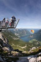
paragliders! Our tour continues below the chapel to the “Pioneer Cross”
where a fantastic viewing platform has been constructed. Here there are
stunning panoramic views towards Hallstatt and the entire World Heritage
Region! From the Krippenstein summit itself, the views of “King
Dachstein” and the Hallstatt glacier are amazing. Don’t forget your
camera! On the way back to the cable car, stop off at the Schutzhaus
and enjoy refreshments out on the balcony. Difference in altitude
approx 70 m. Recommended route approx.3 km. Allow about 30 minutes to
the summit and the chapel; 50 minutes to the Pioneer Cross.
Gjaidalm – Dachsteinblick (for views of the Dachstein)
From Gjaid station (section 3 of the cable car), we follow the
well-established footpath to the Gjaidalm. Pass the Schilcherhaus and
continue in the direction of the Zwölferkogl, until you reach the
Dachsteinblick. Sit on the rest bench here or simply lie down on the
grass and enjoy the stunning views of the Dachstein and the Hallstatt
glacier! On the way back, a visit to the Schilcherhaus is a real must
(excellent regional food specialities!) Difference in altitude approx.
50 metres. Recommended route approx. 3km. Allow about one and a half
hours.
Gjaidalm-Krippenbrunn
This easy walk also begins at the summit of the Dachstein-Krippenstein
cable car (Krippeneck – 1770 metres above sea level). We need to
descend before we ascend, as our destination – the Krippenbrunn
“Bergdorf” – is situated below here at 1568 metres above sea level! We
head first of all in the Gjaidalm direction, and then turn off to the
right and following the sign. After the “Weiderost” (a steel and iron
construction which blocks the path and prevents cattle from going
further!) we keep left and follow the romantic trail beneath the Gjaid
cable car. After a further 20 minutes’ walk, we reach the
“Sonntag-Anger” where we might come across some marmot dens and holes.
Unfortunately, we hardly ever see these shy creatures which live in
groups. We continue our trail through some beautiful alpine flora and
fauna until we reach the “Krippen-Au” turning. You can make a slight
detour here and appreciate the stunning views down to the valley. At
the hut you can sit at tables and take a rest. A further short walk
brings you to the Krippenbrunn “Bergdorf” with its mountain inn
situated on the ski slope. We can now re-trace our steps back to the
cable car or alternatively, climb up the ski slope and return to the
start! Those who wish to prove just how fit they are can follow the
trail which serpentines down through the mountain woodland to the
valley; crossing the ski slope many times. Difference in altitude
approx. 200 m. Recommended route approx. 3 km (descent and ascent).
Allow about one and a half hours.
Däumelsee (lake):
Although we are at an altitude of 2000 m, this walk is fully
unproblematic. We begin at the cable car terminus on the Krippenstein.
The first part of our walk is on the ski slope, and then we reach the
turning for the Heilbronn Cross Circular Trail. Bear left on to this
well-established path. About 30 minutes later we pass the “Little Ice
Cave”. A short distance further is the lake itself which appears hidden
in a little hollow! On the way back we have are stunning views of the
Krippenstein and the vast Dachstein plateau. Difference in altitude
approx. 100 m. Recommended route approx. 2 km (ascent and descent).
Allow about 1 hour.
Medium difficulty mountain tours
Zwölferkogel (1982 m):
Begin your walk at the Schilcherhaus-Gjaidalm (cable car sections 1, 2
and 3). The trail via the Schilcherhaus to the Dachsteinblick and the
Zwölferkogel is well marked. We reach the mountain, from which there
are stunning views, in around 2 hours. The route is well-indicated and
made visible by posts with coloured markings. Appreciate magnificent
views of the Salzkammergut from the” Zwölfer”. On the return journey,
take the time to enjoy delicious home-made cooking at the Gjaidalm! One
final challenge might be to walk to the Krippenbrunn (1 hour) or down to
the valley (2 hours)! Difference in altitude approx. 250 m.
Recommended route approx. 5 km round trip. Allow about 4 hours.
Heilbronn Circular Trail:
Take the cable car from Obertraun (520 m) to the Krippenstein (2100 m).
This takes about 20 minutes. From this summit, you can appreciate the
sheer enormity of the Dachstein plateau. The clearly visible trail
crosses some hilly terrain and there are many mountain pines. After
walking for about an hour and a half, you will have reached the
Heilbronn Cross. This cross is a memorial to the Dachstein Tragedy of
Good Friday 1954. 10 school pupils and 3 teachers lost their lives in
bad weather whilst walking on the Dachstein massif. Continue, in a
westerly direction, along the scenic trail via the little Hirzkar Lake
to the Krippeneck and then to the Gjaid cable car terminus (one and a
half hours). From here it is a 15 minute walk to the Schilcherhaus
where you can enjoy home-cooked food and refreshments. Return to the
valley is by cable car! Difference in altitiude 400 m approx.
Recommended route approx. 6km. Allow about 3 hours.
Wiesberghaus (1883 m):
From the Gjaidalm we follow the well established trail number 650 across
the plateau dominated by mountain pines. After walking for 2 hours, we
reach the mountain hut covered by shingles to keep out the elements.
Return journey is made in reverse. Alternatively, we could make for the
Echerntal valley and Hallstatt via the Tiergarten Hut. We would need
about 3.5 hours for this! Difference in altitude approx. 100 m.
Recommended route approx. 6km (ascent and descent). Allow about 3
hours.
Simonyhütte (Simony Hut) – 2204 m:
At first we follow the same trail from the Gjaidalm towards the
Wiesberghaus. After about an hour and a half, we take a left turning
for the Simony Hut. Enjoy the stunning views of the entire Dachstein
plateau and the Krippenstein, Zwölferkogel, Ochsenkogel, Taubenkogel,
Gjaidstein and soon of course the Dachstein itself. The mountain pines
become sparser, and soon you enter the glacier region. There are
boulders and patches of snow and ice, also present in the summer months,
until we begin our steep descent to the Simony Hut. The serpentine path
to the hut is steep and there are lots of boulders, yet it is completely
safe. The hut was built in 1877 by an Austrian alpine ramblers’
association in honour of Professor Simony. It has been the welcome
refuge of conquerors of the Dachstein massif since alpine tourism first
became popular. Every year, on the first Sunday in September, Holy Mass
is celebrated in the Dachstein Chapel (built in 1914) next to the hut.
Re-trace your steps back to the start. Alternatively, follow the
Trägerweg via the ice lake. Difference in altitude approx. 450 m.
Total recommended route approx. 8km. Allow about five and a half hours.
Taubenkogel (2301 m):
A delightful tour of the Dachstein region. Despite the high altitude,
this excursion is suitable for walkers with a reasonable amount of
experience. Starts at the Gjaid cable car terminus. Follow the
well-established path to Oberfeld (terminus of the armed forces’ cable
car), and then continue for a further 10 minutes towards the
Wiesberghaus/Simony Hut. Where there is a fork in the paths for
Taubenkogel/Gjaidstein, bear off on to the path marked 615. Our way now
is a gentle ascent through pretty pine groves and there are lovely
mountain rose bushes which are at their best in July. We then reach the
ridge of the Niederer Rumpler (1975 m). Ahead of us looms the steep,
rugged and dangerous-looking north face of the Taubenkogel. No need
for panic, though. A further hour’s walk up a mountain slope (the path
twists and turns) brings us to the saddle of the Taubenkogel. Depending
on the time of year, there might be some patches of snow, and caution is
needed here. In high summer, the area is covered by beautiful alpine
flowers. From the shoulder of the mountain, the summit of the Dachstein
and its glacier appear in full glory. The remaining half hour’s hike to
the summit is easy. There is a cross on the actual summit, and it is
now time to take a well-earned rest. A truly unforgetable experience.
Difference in altitude approx. 550 m. Recommended route (round trip)
approx. 7 km. Allow about 5 hours.
Strenuous mountain tours
Circular tour of the Dachstein:
Take the cable car from Obertraun to the Gjaidalm where our challenging
route begins. Allow 2 days fro this tour. We hike up to the
Wieseberghaus (about 2.5 hours) where we can stay overnight. Setting
off early next morning, we can enjoy watching the sun rise as we head
fro the Simony Hut. The route is steep and challenging (allow about 1.5
hours). We are now at the foot of the glacier and at an altitude of
more than 2200 m. After taking a rest, we return to the Gjaidalm via
the Zirbengrube. Allow 3 – 4 hours. Make sure you do not miss the last
cable car back down to Obertraun! Difference in altitude approx. 1300
m. Recommended route approx. 12 km round trip. Allow about 10 hours.
Obertraun Sarstein Hut (1650 m)
Our tour begins by the catholic church in Obertraun. At the upper grave
yard, turn off on to a forest track which leads us to the Brettstein
(lovely views of the Obertraun valley). Follow the path marked 692
(there is only one marked trail on the Sarstein!) This takes us via the
Almriedl to the Brindlleiten where we get our first scenic views of the
Dachstein. After a further 2 hours we reach the “Goiserer Aussicht”
(stunning views), and 1 hour later we reach the Sarstein Hut.
Refreshments are available here from the beginning of July to the middle
of September, at weekends only. If you wish to use the hut outside of
these times, a key can be obtained from Franz Kysely, 4831 Obertraun
42. Tel: 06131/213. You need a further 1.5 hours to walk to the summit
of the mountain, or you can complete a traverse of the Sarstein and walk
to Bad Goisern in 2.5 hours. (Transfer back to Obertraun needed.) Holy
Mass is celebrated on the Sarstein each year on the last Saturday in
August. Difference in altitude approx. 1100 m. Recommended route
approx. 7 km round trip. Allow about 6 hours.
Modereck (2002 m):
Begin your tour at the Gjaidalm. For most of our tour we will follow
trail number 616 (the route to the Guttenberghaus). This is a
well-established path through boulders and pine groves. After walking
for about an hour, make sure you do not ignore a small, well-trodden
path to your left. Follow this path, and in just a few minutes you will
reach a plateau with a tiny little hut which is used by mountain
shepherds. The Modereck Hut is in a very remote part of the Dachstein
world. Situated at 2002 m above sea level, this mountain pasture is the
highest in the Dachstein area. The oldest part of the hut dates back to
the 16th century! Difference in altitude approx. 250 m. Recommended
route approx. 9km. Allow about 3 hours.
Traverse of the Sarstein:
Our tour begins by the catholic church in Obertraun. At the upper grave
yard, turn off on to a forest track which leads us to the Brettstein
(lovely views of the Obertraun valley). Follow the path marked 692
(there is only one marked trail on the Sarstein!) This takes us via the
Almriedl to the Brindlleiten where we get our first scenic views of the
Dachstein. After a further 2 hours we reach the “Goiserer Aussicht”
(stunning views), and 1 hour later we reach the Obertraun Sarstein Hut.
Refreshments are available here from the beginning of July to the middle
of September, at weekends only. Continue along the path behind the hut
to your left, next to a small pond. Your route is a gentle ascent
between pine trees. After an hour, you will come across the ruins of a
former stone hut. The summit (1975 m) is a further hour’s walk. Five
hours since we first set off, we are rewarded with stunning panoramic
views of the mountain peaks of the Salzkammergut. You can make your
descent via the Goisern Sarstein Hut (steep, curving path), and you soon
the alpine huts come into view. About an hour later you will have
reached the serviced mountain hut where you can enjoy a well-earned rest
and watch the cattle peacefully graze. We continue our quick descent to
the valley by means of a path which twists and turns. We soon join the
woods, and after about 2 hours, reach the Pötschenkehre. We can either
call a taxi from here, or walk to Steeg railway station and take the
train back to Obertraun. It is, of course, possible to complete this
mountain tour in reverse! Difference in altitude approx. 1450 m.
Recommended route approx. 11 km. Allow about 8 hours.
“Am Stein” – mountain plateau traverse
Take the cable car to the Gjaid terminus (1770 m). For most of our tour
we will follow trail number 616 (the route to the Guttenberghaus). This
is a well-established path through boulders and pine groves. You can
really appreciate the enormity of the Dachstein massif. Even though we
sometimes descend a little as we follow the path, we are still gradually
gaining height, and vegetation becomes sparser and the terrain rockier.
Four hours later we reach the highest point in our tour – the
Feistererscharte (2198 m above sea level). From here we follow a
rocky, narrow path down to the Guttenberghaus (2146 m). This takes
about half an hour. Enjoy a well-earned rest now! We have now
completed our traverse of the Dachstein plateau from north to south, and
begin our descent. The terrain is rocky in parts, and part of our route
is a scree slope. The path curves steeply down towards the valley and
we make quick progress – after just 1 hour we are already at an altitude
of 1500 m. A further half hour’s walk brings us to the Lärchboden Hut
(1406 m). As we are a little weary now, it will take us another hour to
reach the “Pension Feisterer” (1150 m). Take a taxi from here to
Schladming station where you can take the train, feeling tired but
happy, back home to Obertraun. Difference in altitude: 430 m ascent,
1050 m descent. Recommended route approx. 12 km. Allow about 7 hours.
Landfriedalm (1345 m):
Park your car at Koppenrast inn. Behind the inn, follow the right-hand
trail past the Koppenwinkel Lake to the Koppenwinkelalm pasture (536
m). Follow the trail to your left which, at the edge of the pasture,
leads to the mountain. In just a few minutes, the path weaves its way
past some stone remains. Our ascent is quick as the path is step.
After just 2 hours, we will have completed most of our ascent. To our
right is the Ghangkogel from where there are some wonderful views down
towards the valley. Soon afterwards, we reach a huntsman’s hut. Take
care here – the route is indicated only by stones. Follow this trail
to the Obertraun Landfried (1345 m). There are some mountain huts here
which are partly dilapidated. Be careful not to stray from the path
here, and just minutes later you will reach the Altarstein (“Altar
Stone”) at 1355 m. This is an ancient, enormous rock, and is covered in
pines. It was used in the Middle - Ages as a boundary stone, and today
it still marks the border between Upper Austria and Styria. It is also
fondly known as the “Andachtstein” (“Worship Stone”) or the “Betstein”
(“Prayer Stone”). Many years ago, it was used by herdswomen as a place
of worship. A short while later we reach the Aussee Landfriedalm. It
is like being transported back 100 years in time. The mossy stones and
undisturbed wildlife remind us almost of the wilderness. Cows graze
peacefully by the hut in the hollow. Calves are still driven up from
Aussee to this mountain pasture. The hut itself is situated on an
ancient mountain path. A 3000 year old bronze axe was once found here
and is now exhibited in the Natural History Museum in Vienna.
Discoveries dating back to Roman times have also been made here, as well
as in other parts of the Salzkammergut. Enjoy your packed lunch here
before re-tracing your steps to the Koppenwinkelm in the Obertraun
valley. This should take about 2.5 hours. Difference in altitude
approx. 820m. Recommended route approx. 6 km. Allow about 5.5 hours
in total.
Climbing paths
The lake mountain-side climbing path has been built by the Tourist Association of Obertraun in cooperation with Heli Putz (outdoor-leadership). Its starting point is the parking area at the Kessel bathing spot between Hallstatt and Obertraun.The access to the climbing path is above the Hirschau Alp (about 30 min.). For the climbing of the lake mountain-side itself you should plan about 4-5 hours. During the climbing you have a magnificent panorama view of Hallstatt and the Interior Salzkammergut. You leave the climbing path on the Dachstein elevated plateau from where you can use a beautiful alpine path with a fascinating view of the Dachstein to reach the Dachstein Alp after about 30 minutes.From there, visitors have the possibility to get back to the valley by the Dachstein cable car; those who prefer walking should plan further 2 hours (optionally for the ski descent or from the Schafeck/Hanzinger alpine hut over the Winkler Mountain).Largest climbing path of the Alps with a difficulty level D-E (according to a scale of A-E), difference in altitude from the parking area at the lake (P) to the Gjaid Alp about 1,100 m, total duration: about 6 to 9 hours depending on your physical fitness!Special price for all users of the climbing path for the Dachstein-Krippenstein cable car down to the valley of Obertraun!Further information is also available at the tourist office of Obertraun at 06131/351!
Theme trails
Koppental “Wilderness Trail”:
There are many opportunities all along the trail, which stretches from
Bad Aussee to Obertraun, to discover something of the history of the
Koppental valley. At 11 points along the “Wilderness Trail”, there are
large display boards which tell us something about local wildlife,
hunting traditions, ancient footpaths, major avalanches, wood drifting
on the River Traun, the history of the railway, the Koppenbrueller Cave
and much more. The boards also display some drawings and illustrations
which are of historical interest. Difference in altitude: 100 m.
Suggested route approx. 9.5 km. Allow about 3 hours (excluding visit to
the cave).
Obertraun Theme Trail:
The trail begins by the “Gemeindeamt” (local authority office). Close
by, you will find the first display board with details of the exact
route. We pass the catholic church and walk down to the lake before
joining the “Obertrauner Höhenwanderweg” (elevated trail). We follow
this to the Koppenwinkel and continue along the trail to the
Dachsteinhof inn. Just past this inn we cross the Traun before
joining the Höll- Karl-Weg back to the main street and the start of our
walk. There are display boards all along the route with information on
the numerous waterfalls and springs in the region, and about life and
local employment in this little valley. This trail is 9km long, and is
accessible to all as it is almost perfectly flat. Allow about 3.5
hours.
Discovery trail to the Ice Cave: “A stroll through alpine
flora and fauna”:
As you enjoy your stroll from the cable car terminus on the Schönbergalm
to the entrance to the ice cave, there are display boards telling you
about plant life in the Dachstein region. There are numerous species of
plants and wild flowers which grow down by Lake Hallstatt and right up
to the Dachstein summit (500 to 3000 metres above sea level). These
wild plants and flowers add to the character and charm of this beautiful
part of the alpine world.
Discovery trail to the Mammoth Cave: “A short stroll through the
history of the earth”:
Follow this theme trail (550 metres long) from the Schönbergalm (section
1 of the cable car) to the entrance to the Mammoth Cave. Learn about
the last 550 million years in the earth’s fascinating history, and find
out how long there has been life on our planet. Mankind has only
existed for a very short while.
Further Information:
Tourist Office Obertraun
4831 Obertraun Nr. 180
Tel. +43 6131 351
Fax: +43 6131 342 22
obertraun@inneres-salzkammergut.at
Dachstein Tourismus AG
Winkl 34
4831 Obertraun
Tel. +43 50 140
Fax: +43 50 140-12 300
info@dachstein-salzkammergut.com
www.dachstein-salzkammergut.com
Landhaus Osborne - Ebnerstegweg 148 - 4831 Obertraun - Austria | Tel: +43 681 103633 84 | Email: info@landhaus-osborne.at

